We were up at dawn. My parents said they wanted to put some miles between us and Amarillo before stopping for breakfast. Patty’s coughing and the noise of the wind kept everyone restless throughout the night. As Mom got us ready, Dad loaded the car and rearranged things in the back seat.
The sleeping bags were now stretched out on top of the seat and our boxes of stuff were on the floor. I hopped in and sank onto the now cozy cushioned bench seat. He smiled and handed me my stack of comic books. Meanwhile, Mom carried my sister — clutching the oatmeal teddy bear she always slept with — and slipped her in between the two sleeping bags. She was asleep before we pulled away from the motor court.
The Texas panhandle let us go gradually. For the first hour the land looked the same — flat, brown, the highway a straight crease in the pale morning. We passed a sign that said we were 30 miles from the New Mexico border. Soon after, the car began to slow and pull off to the right and stopped in front of large white sign. Mom asked if I recognized any of the words on the sign.
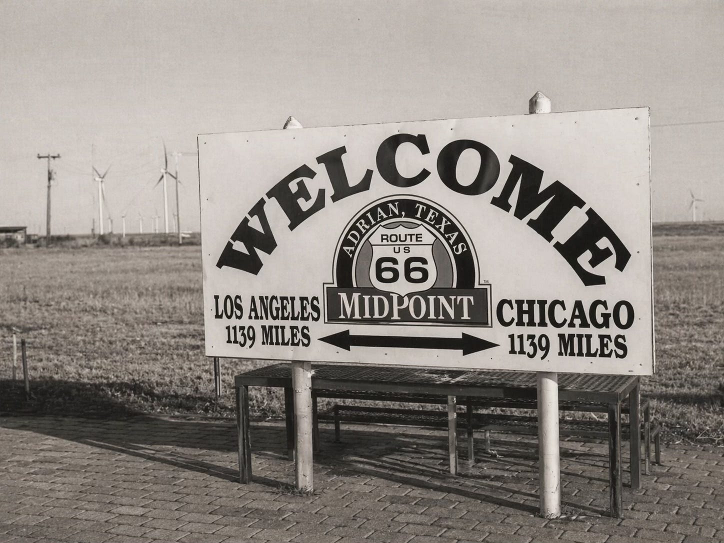
I could sound out the large curving WELCOME, but then right under it I saw and called out, “Adrian! Wait, Adrian?” They both laughed. Adrian College is where they met and married. It was also the town where I was born. So, yes, I recognized the word. Adrian, Texas, shared the name with the one in Michigan, but that was where any similarity ended.
Fewer than 300 people lived in this flat, brown town. Dad guessed the only reason it existed was because it was the midpoint of Route 66. In 1928, just two years after the commissioning of the road, The MidPoint Diner was built between a motel and a filling station. A little micro-economy based on the Mother Road traffic and the notoriety of its midpoint status.
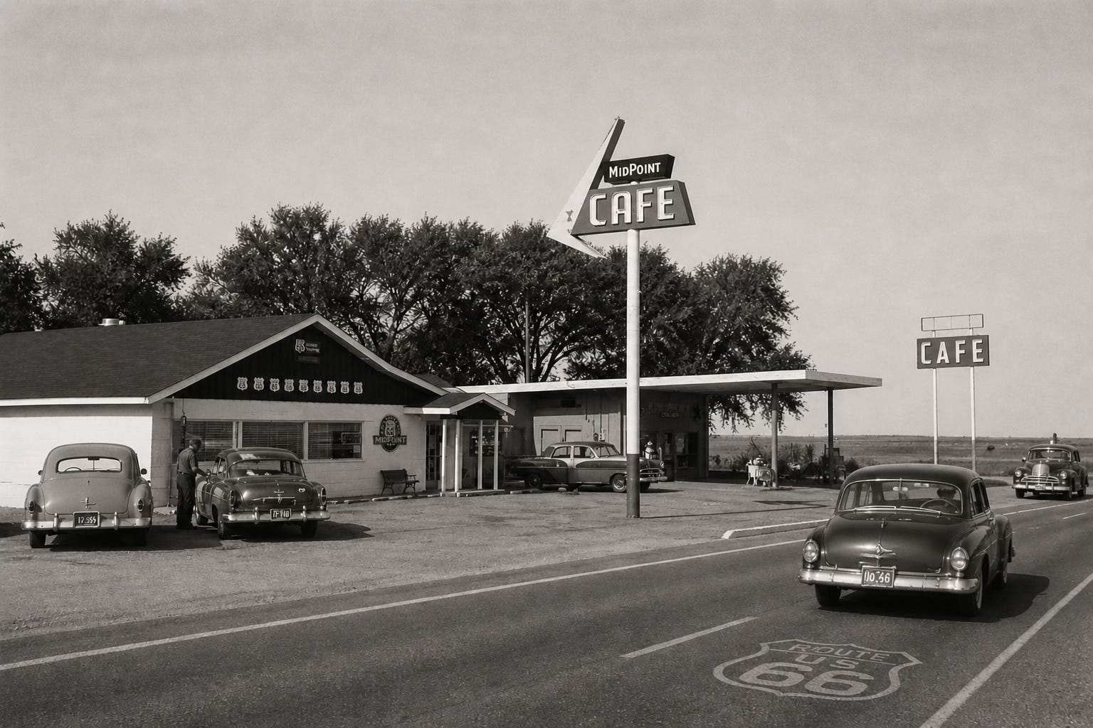
We had breakfast at the café, which was in its heyday and oblivious to its future as the basis for Flo’s V-8 Café diner in the Pixar movie Cars. As we ate, Dad explained that there were at least two other Texas towns between Adrian and Amarillo that claimed to be the Midpoint: Bushland and Vega. It was hard to pinpoint, he said, because the given length of the highway changed a few times due to re-routing in the early years. Adrian must have done the best job promoting itself.
Back in the car, the road began to climb almost imperceptibly, and the light changed. By the time we crossed into New Mexico the sky was enormous in a way it hadn’t been before, a deep winter blue that seemed to begin directly above the car and extend without interruption to the horizon in every direction. Even Patty seemed to be feeling better after eating and putting the Texas panhandle behind us.
We were on the high desert now. The elevation at the New Mexico line was already higher than anything in Michigan. By the time we reached Albuquerque we’d be driving at a mile above sea level.
New Mexico announced itself in other ways too. The roadside began to change — trading posts appeared, low adobe buildings with hand-lettered signs offering turquoise jewelry, blankets, pottery. The colors of the landscape shifted from the flat browns of Texas toward something more complex: red rock, ochre, the pale sage green of desert scrub. The light had a different quality, thinner and cleaner, casting hard shadows even at mid-morning.
Somewhere on the eastern edge of New Mexico, my mother found a radio station.
She’d been trying to lock in a signal since we left Amarillo — a few bars of something, then static, then silence, the signal dropping away as we moved through the thinly populated land. Then she found it: a strong, clear signal out of Albuquerque. KOB, 770 on the dial, running 50,000 watts across the high desert. The music filled the car and we all began to move subtly to the beat. The oatmeal teddy bear on my sister’s lap, its hands enclosed by Patty’s, clapped rhythmically. Dad hummed and Mom swayed slightly. I kept reading one of the comics, but was tapping my knee. After several songs, Mom suddenly leaned forward and turned up the volume.
She had recognized the song before a full measure had played — the close harmonies, the irresistible swing of it. The Andrews Sisters. And the song they were singing was about the road we were driving.
If you ever plan to motor west, travel my way, take the highway that’s best...
My mother turned it up further. She knew every word.
It winds from Chicago to L.A, more than two thousand miles all the way
Get your kicks on Route 66
Now you go through St. Louis, Joplin, Missouri
And Oklahoma City looks mighty pretty
When it ended my father let a moment pass, then said, almost casually, that Nat King Cole’s version was better.
My mother turned to look at him.
What followed was not an argument, exactly. But it was the most animated I had heard her on the entire trip. The Andrews Sisters had phrasing. They had energy. Nat King Cole, she allowed, had a beautiful voice — nobody was saying he didn’t have a beautiful voice — but the song was about traveling across the country and the Andrews Sisters made you feel it. She was mid-sentence, making another forceful point, when she trailed off. She noticed him watching her with a dimpled smile and a twinkle in his eye. He may have lost the argument, but he got exactly the reaction he was going for.
In the back seat, I looked over to Patty with wide eyes. She tried to match my expression and we both started giggling.
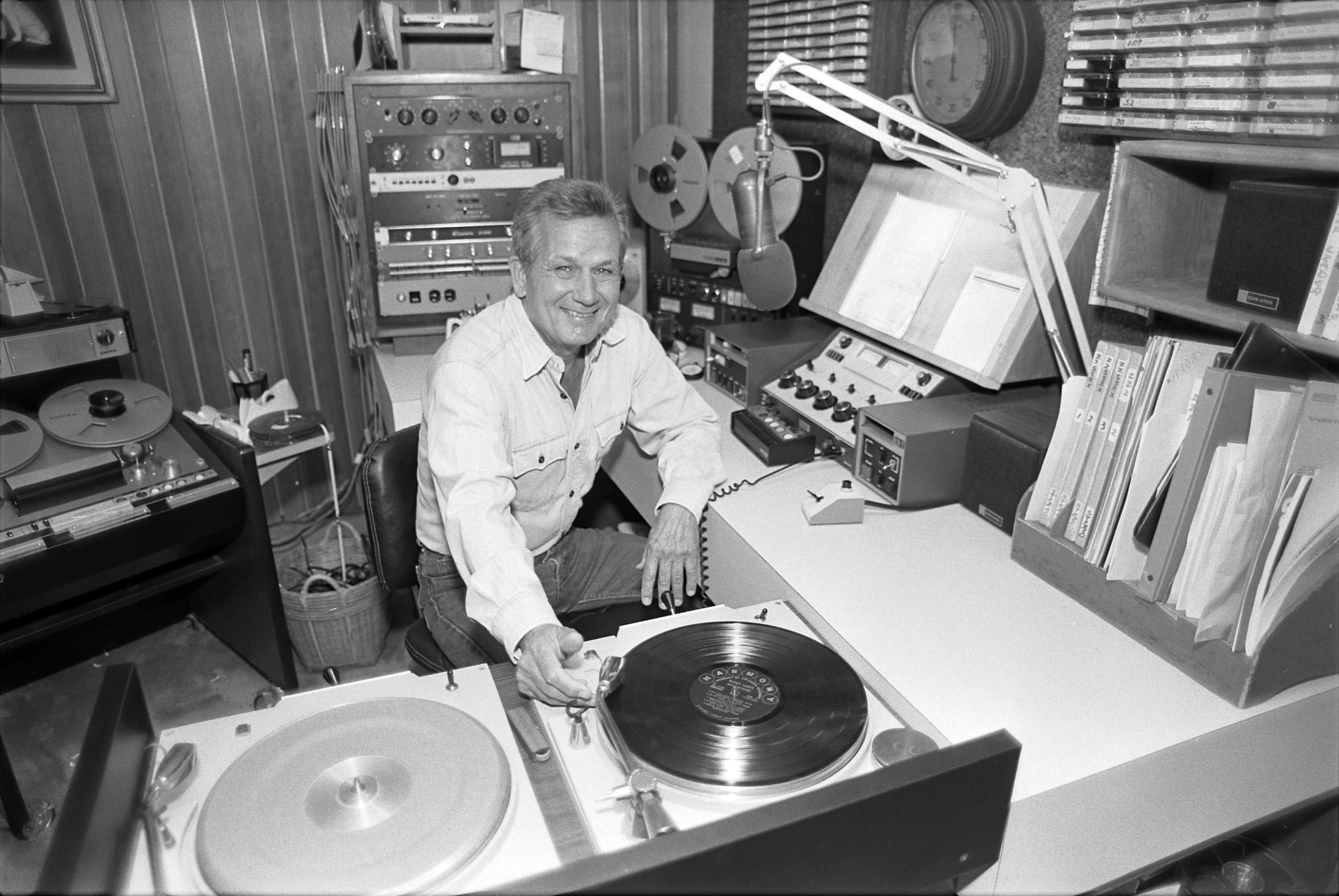
The signal held strong for hours, all the way across the high plateau toward Albuquerque. I don’t know what else we heard that day — other standards, other voices from that era my parents had grown up in. But I know my mother hummed for a while after the station finally faded, somewhere west of the city. She had loved that music since she was a teenager. She would love it for the rest of her life. A big band show called The Swingin’ Years started in 1956 out of LA’s KFI-AM 640. Twenty years later it was the longest running radio music show ever and syndicated in hundreds of other stations around the country. For several hours most every weekend, she listened to it faithfully.
Albuquerque sat in the Rio Grande valley, framed by the Sandia Mountains to the east — a range that turned a deep, improbable pink at sunset, giving them their name. In 1953 it was a city of about 100,000, growing fast on defense money and the postwar boom, with a cultural texture entirely unlike anything we had passed through: Spanish colonial architecture, Native American markets, an older and more layered history than Chicago or St. Louis or Oklahoma City. Route 66 ran down Central Avenue, through the heart of it.
We didn’t need to search for a motel. We just stopped when we saw a VACANCY sign on a place that looked nice. That was the great thing about Route 66.
Before breakfast, I had managed to get the Southwest U.S. road map out of the car while Dad was packing up. I set it in front of my mother at the diner and told her I wanted to find the cities from that song we heard on the radio the previous day. She opened it and drew a circle around Amarillo and another one around Albuquerque, explaining Amarillo was the last city from the song that we had been through and that Albuquerque is where we had just spent the night. I tried to watch carefully as she folded the map back up.
You’ll see Amarillo
Gallup, New Mexico
Flagstaff, Arizona
Don’t forget Winona
Kingman, Barstow, San Bernardino
We would sing the song together during the day when I needed reminding which cities I needed to find next.
West of Albuquerque the land changed again. The road climbed out of the valley and into a landscape of dramatic mesas and volcanic formations, the highway cutting through terrain that looked, to my five-year-old eyes, like the surface of another planet. This was the western edge of the Colorado Plateau — ancient, vast, the geology exposed in the canyon walls and roadcuts like pages of a book laid open.
In the next two days of driving through New Mexico and Arizona, I would be looking out the window at “Indian country,” where more than two dozen federally recognized tribes lived on reservations occupying about 20% of the area of the two states. A 5-year-old in 1953 — raised on westerns and schooled with textbooks written from a Euro-American perspective — had no way of knowing the true history and current plight of our Native American population.
The road that Euro-American commerce had built across the Southwest was running, for hundreds of miles, through sovereign nations whose presence predated the United States by centuries. This was not a single “Indian culture” but a mosaic of peoples with different languages, histories, and traditions. Yet, the trading posts and roadside imagery visible along Route 66 collapsed all of that into a single Hollywood stereotype.
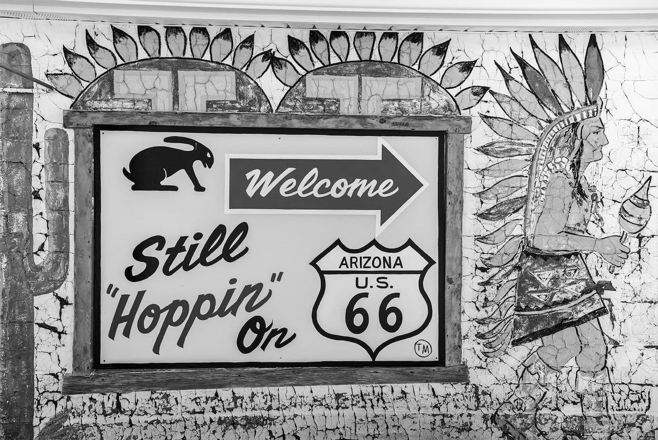
There was, for example, the Jack Rabbit Trading Post. It was founded in 1949 and became famous for countless billboards and signs that populated the Mother Road between Missouri and Joseph City, Arizona. They were painted on barns, fences, outbuildings, and water towers with the words HERE IT IS. The same words, over and over, with a silhouette of a jackrabbit leaping. My father called them out each time. I started trying to call them out before he could.
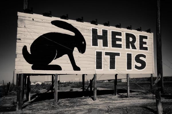
By the time we reached the actual trading post — a low building with a giant jackrabbit statue out front — I couldn’t wait to spend some of my money. When we got back in the car after walking through the store and using the restrooms, I had bought a pack of gum for a nickel and was wondering what was so special about this place.
The Petrified Forest and the Painted Desert lacked the promotion but were, in fact, special.
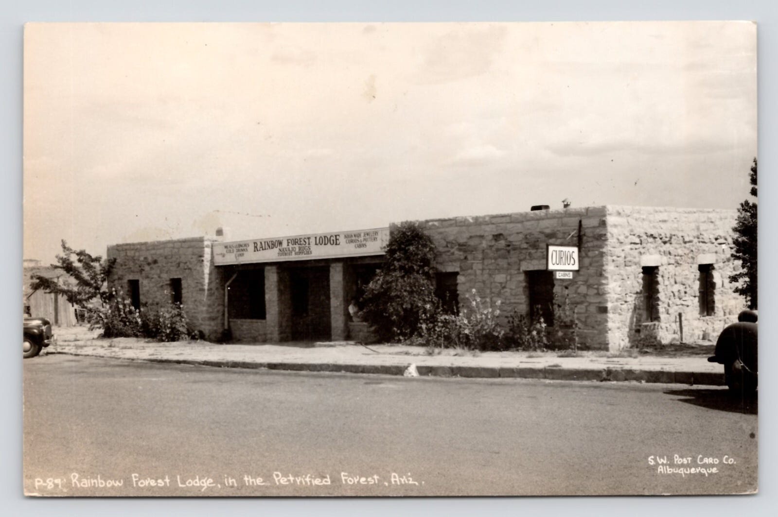
We had stopped for lunch about 30 miles before the Jack Rabbit Trading Post, turning off the highway to find the Rainbow Forest Lodge. Serving as Visitor Center, Museum, and Curio Shop for the Petrified Forest National Monument — not elevated to full park status until 1962 — it had been built by the Roosevelt Administration’s Civilian Conservation Corps (CCC) in the 1930s. Inside we chatted with the Ranger, who said there were a couple of picnic tables out back.
As was their custom as far back as their first year of marriage and as recent as several times on Route 66, my parents had picked up groceries for lunch shortly before arriving at the Lodge. My memory of this quirky tradition began on this trip but was reinforced many times over the next decade or more. We would find a grocery with a deli counter and ask for an assortment of sliced cold cuts to fulfill everyone’s choices, such as bologna and several pre-sliced, gelatin-bound loaves: olive loaf (containing pimento-stuffed olives), pickle loaf, pimento loaf, and pepper loaf. Liverwurst was popular with the adults. A couple types of sliced cheese. A loaf of white sandwich bread. Because the “sandwiches” were dry — i.e. slice of bread, slice of cold cut, slice of cheese, fold and eat — a quart of cold milk was the final requirement in order to swallow. Paper cups, newly available in the early ‘50s, could have been on hand but I recall numerous occasions when we simply passed the quart of milk around.
Having a picnic table would have been our equivalent of dining out. More common was either Mom passing out the sandwiches as she made them in the moving car or simply standing outside the car and eating. Once we graduated to a station wagon, the tailgate served as buffet table.
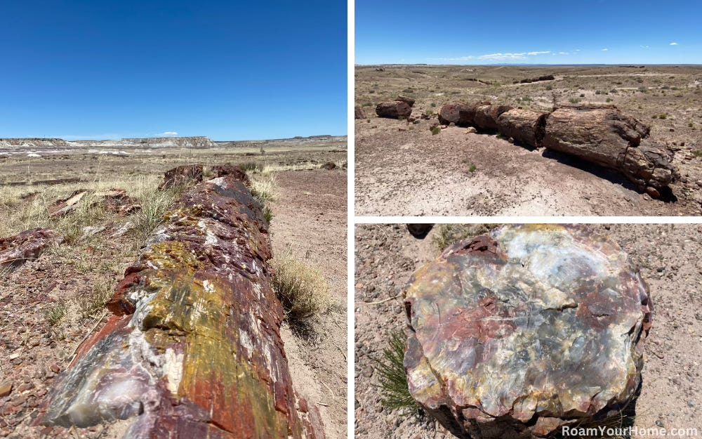
We would have noticed a short loop trail near the picnic tables, the Giant Logs Trail. On a 10-15 minute walk we would have seen some of the largest and most colorful petrified logs in the whole Petrified Forest. Their origin was an ancient log jam in a Late Triassic river. We stopped at a plaque that explained that they had turned entirely to crystal two hundred million years before, the wood replaced molecule by molecule with silica until each log was stone, the grain still visible, the colors extraordinary — red, purple, yellow, gray — scattered across the desert floor as far as you could see.
That’s when Mom noticed different layers of color. Studying the map the Ranger had given her she pointed where to look to see the Painted Desert in the distance.
The Ranger came out as we returned to the car. He was smiling, but he told us that the park was losing tons of petrified rock every year since the monument was established in 1906. He was looking right at me when he said he just wanted us to know and make sure we hadn’t put any souvenirs in our pockets.
Arizona was the longest state on Route 66 — nearly four hundred miles of it. The landscape through which the road passed was among the most dramatic on the entire route: the Painted Desert giving way to the pine forests around Flagstaff, then the long descent from the Colorado Plateau through the Black Mountains to the Mojave. But today, our goal was just to make Flagstaff.
It was getting late in the afternoon by the time we left the Jack Rabbit Trading Post. Patty was getting squirmy on Mom’s lap, a sign she was getting tired. Afraid it was too late for a nap, Mom asked me to play with her to keep her awake. I thought of a game I had learned on the playground at school. Rock Paper Scissors. It proved to be a good choice because it took some time for her to understand and then remember what beats what. She was apparently a believer in raw, brute power, because she chose Rock like ten-fifteen times in a row. Finally, she chose Paper to my Rock and her face lit up.
Mom called for us look out the front window. Patty crawled over the seat back to Mom’s lap and I took my place on the hump. We were about halfway between Winslow and Flagstaff. I was thinking I could put a check next to the circle I had drawn around Flagstaff on the map once we got there. Then I noticed the sunset over snowy mountains. We probably didn’t know the mountains were the San Francisco Peaks, or that Humphrey’s Peak was the highest point in Arizona at 12,633 feet.
Flagstaff may have come as a surprise, too. At 7,000 feet, it was the highest point on Route 66, and the ponderosa pines that surrounded it looked nothing like the desert we’d been driving through for two days. In December the snow here was real — not the glazed-road snow of Chicago but deep mountain snow, the trees weighted with it, the air thin and cold. At the motel my father checked the road conditions and the weather we should expect in the morning while we were getting ready for bed.
The descent from Flagstaff toward Kingman was once Route 66’s most notorious stretch — the Oatman Highway, a series of switchbacks through the Black Mountains that had terrified drivers for decades. But in 1953 a newer route through the mountains had just opened, bypassing the worst of it. We almost certainly took the new road. Even so, the descent was dramatic — the highway dropping thousands of feet, the desert floor opening below, and then suddenly the Mojave: flat, vast, and warm.
Warm.
After a week of December cold, the temperature change was physical. Windows went down. My mother said something about the air.
The Mojave in December is not hot — daytime temperatures in the fifties, nights still cold — but after Chicago and the panhandle and the mountain pass, it felt like another season entirely. The light was different too: sharper, more direct, the sky a deeper blue than anything we’d seen since leaving Michigan.
With mostly desert to see out the car windows, I turned my attention to the road map I’d been using to check off the song’s cities. I nearly gave up the whole enterprise in Arizona because the cities in the song and on the map just weren’t making much sense. I couldn’t find Winona anywhere on the map. When we stopped for gas, Dad asked for an Arizona map and mentioned we couldn’t find Winona on our map. The man chuckled and explained that Winona was in the song because it rhymes with Arizona. It’s just a part of Flagstaff. “That’s why the song says, “…and don’t forget Winona.”
OK, I thought, Kingman should be next. I hadn’t found that on our Southwest U.S. map either, but now we had an Arizona map. I found its tiny dot and circled it. Later, Dad slowed down and asked if I wanted to see Kingman. I looked up and he was pointing at the city sign as we approached. He read it out loud, “Welcome to Kingman—Population 3,342.”
“Is that a lot?” I asked. Three traffic lights later we were out of Kingman.
One nice thing about driving in the desert was we made pretty good time. Fewer and smaller cities. Straightaways without much traffic meant our speed was often higher than average. And we loved, really loved, the DIPS. Sometimes Dad would give us a heads up by reading the sign, “DIP AHEAD”. Then we’d anticipate the sensation and laugh when we hit it. Sometimes there would be no warning. We’d go “Whoa!” and THEN he would call out “Dip!” Loved the dips.
Barstow was the last significant stop before the final stretch of Route 66. With a population of just under 7,000 it had a strong economic base in 1953, which rested on the Santa Fe Railroad, the Marine Corps Logistics Base, and a steady flow of cross-country travelers. The Harvey House (1911-1971) served train and road passengers on fine china, staffed by the famously professional Harvey Girls. Fortunately, there were several other suitable options for the family of a teacher/principal between jobs and homes.
I imagine our choosing to celebrate our first night in California with dinner at Rosita’s Restaurant and finding lodging at La Casa Court (“The Home of Cleanliness”) at 1101 West Main Street. According to LegendsOfAmerica.com, Barstow was the only city on Route 66 — the Main Street of America — to retain “Main Street” as its actual street name.
Over dinner, my parents discussed our options for the next day, December 24, Christmas Eve. We could drive over the San Bernardino Mountains to my grandparents’ house in Palm Springs or stay on Route 66 and go via the city of San Bernardino itself and then backtrack slightly to Palm Springs. Either choice involved about 3 hours of driving. Since they knew an area in San Bernardino called Muscoy might have available housing in the new year, we would drive through it to see how it might suit us.
As we drove the 71 miles from Barstow to San Bernardino, my parents talked about seeing the family already here and where and when we would have our own home. Patty had been increasingly interested in coloring a Disney coloring book bought along the way. I looked out the window but I was forming mental images of my grandparents and especially my Uncle Ron.
We had left Michigan before Christmas vacation had begun in hopes of arriving in time for Ron’s birthday on Christmas day. He would be 14 tomorrow, closer to my age than my father’s, his older brother. I thought of him more like a big brother than an uncle. And he was a really good big brother.
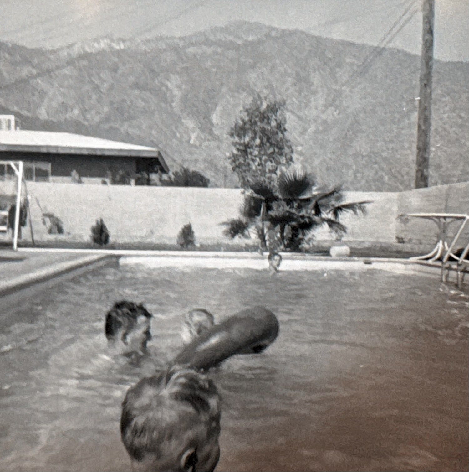
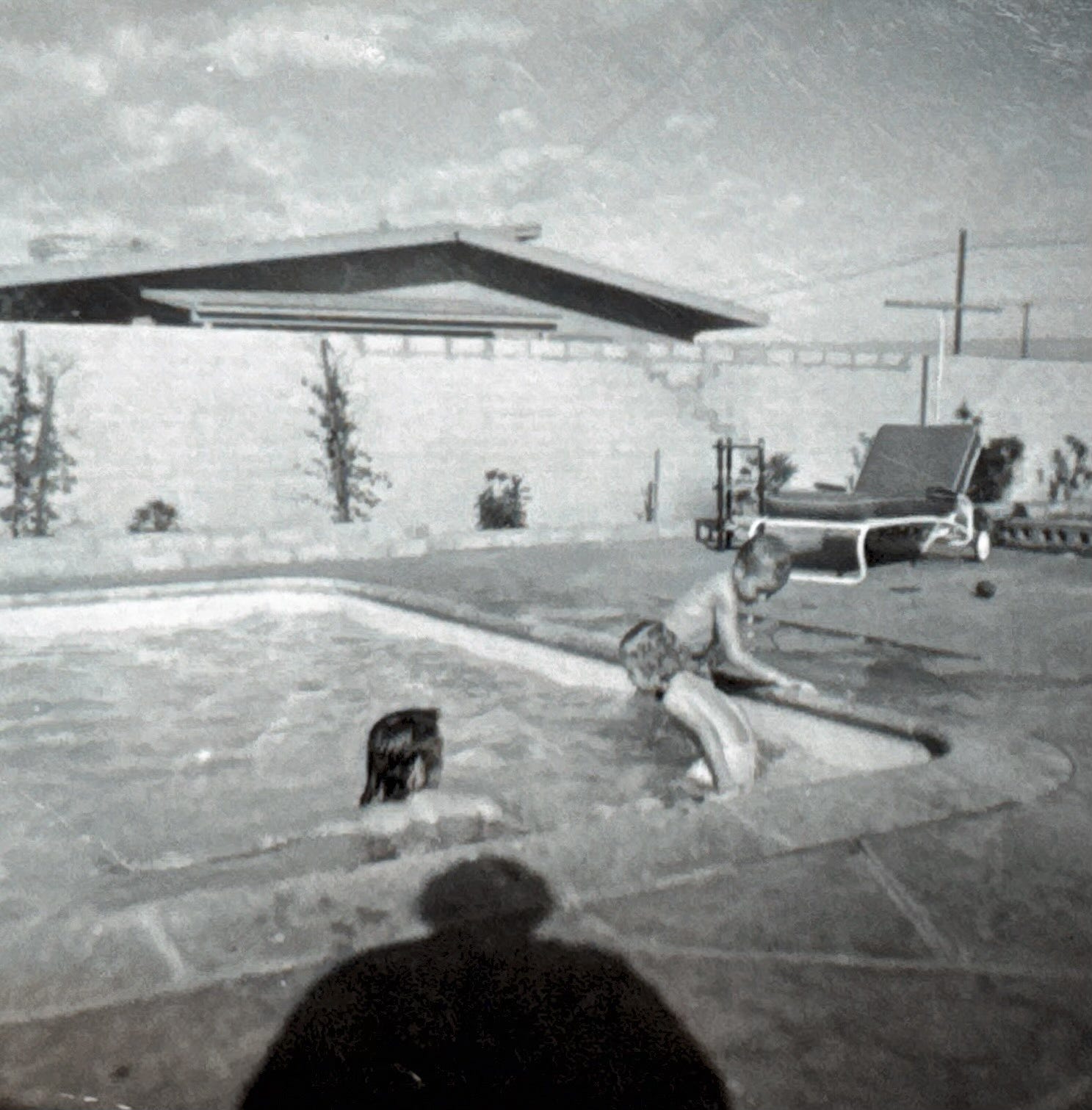
My thoughts were interrupted by my father’s voice. “You did bring your swimming suit, didn’t you?” It was what he said several times on the drive to remind me what might be waiting for us at the end. A drive from the snow of Michigan and Illinois to my grandparents and a swim on Christmas day. Very cool, I probably thought. But I expected that.
I had had no idea how cool the drive itself would be.